What the Cold Keeps
Iceland's ring road in seven days, anticlockwise, in a camper — waterfalls, a glacier lagoon, a boiling plain and a cave full of blue water, and scattered along the same eighteen hundred kilometres an aeroplane that was driven the length of the country, a wartime wreck at the head of a fjord, a Viking village built for a film nobody ever made, and a herring boat standing on the shore that built her.
- Route
- Keflavík → Reykjavík
- Stops
- 14 + 8 side
- Suggested
- 7 days
- Driving
- ~1,780 km
When · Late August to early October. September is the sweet spot — the whole ring and the mountain roads are still open, the campsites haven't shut yet, the summer traffic has gone, and the nights are finally long enough and dark enough for aurora. Do this in winter and it is a different trip with half the stops closed.
Every other route in this journal is an argument about buildings. This one is mostly an argument about weather.
Iceland has one road that matters. Route 1 goes round the outside of the island in about thirteen hundred kilometres, and everything worth stopping for is either on it or on a spur off it. We took a camper from Keflavík, drove it anticlockwise for seven days, cooked at the campsites, slept in it, and came back to the airport having done the whole circle. That was the plan and we completed it exactly, which almost never happens.
Why this route is mixed
I came here for the wrecks. There is a wartime landing craft rusting at the head of a fjord that I had wanted to stand in front of for years, a US Navy DC-3 that somebody put on a trailer and drove seven hundred kilometres across the country rather than let it disappear, and a wooden herring boat propped on a cradle in the town that built her in 1955.
What I got was that, plus a week of the most aggressive landscape I have ever driven through, and the honest thing is to admit that the landscape won. So this guide is not a list of ruins with some scenery in between. It is a route where a boiling mud plain, a lagoon full of thousand-year-old ice and a canyon cut by a glacier that no longer exists sit on the same map as the abandoned things — because that is the order you actually meet them in, and because in Iceland they are the same subject.
Everywhere else I go, buildings are being taken apart by cities. Here they are being taken apart by weather, and the weather is also the reason you came.
The shape of the week
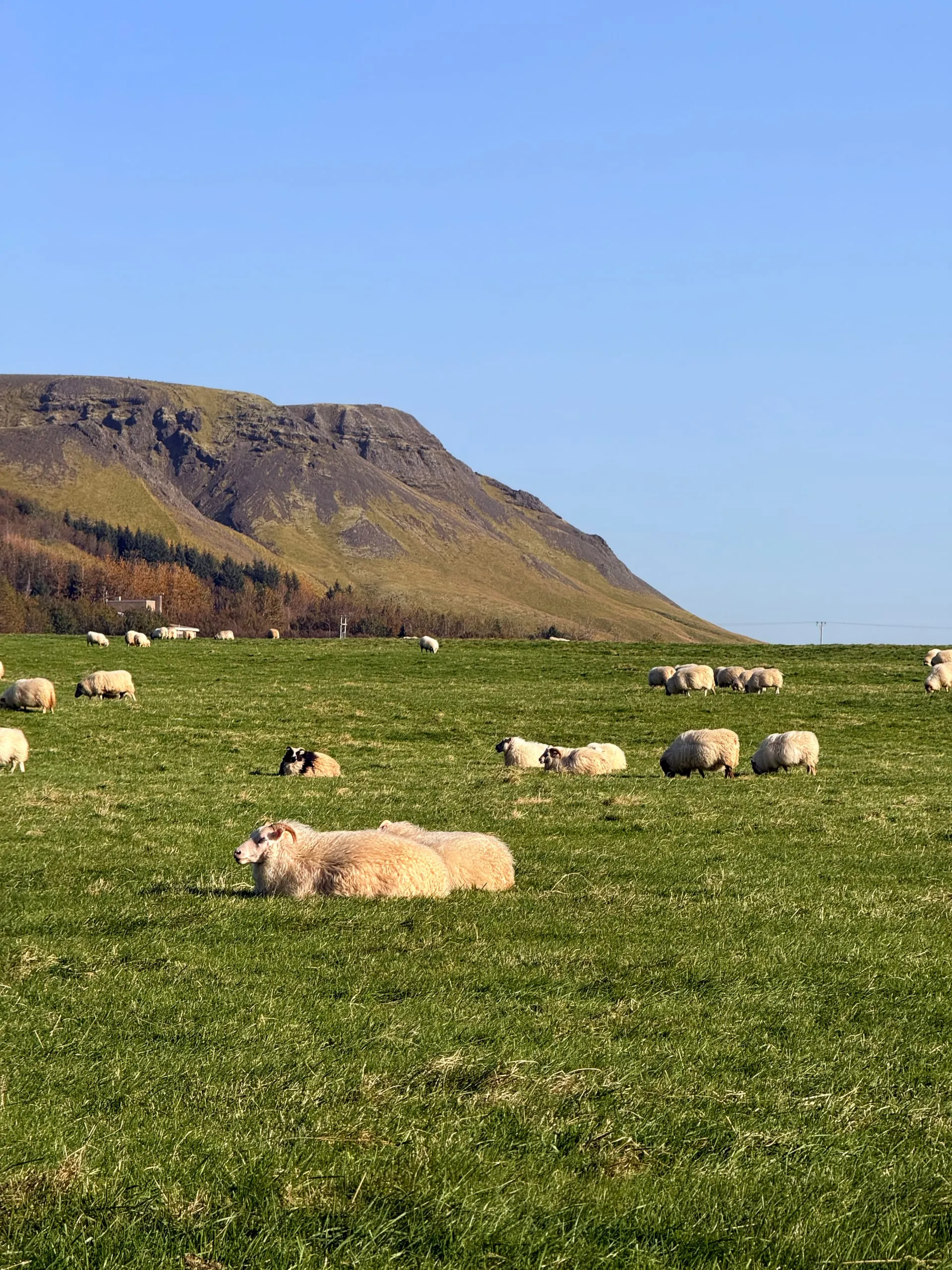
Day one is the south coast: the DC-3 in its meadow, a waterfall you have to wade into a cleft to see, Skógafoss making its own rainbow, and a canyon at last light. Day two runs under Vatnajökull — a 1974 memorial chapel that is one enormous roof, a wall of basalt columns at Svartifoss, a turf church that you have to look twice at to find, and then the glacier lagoon.
Day three is the one to build the trip around. You wake on the black flats at Stokksnes under Vestrahorn, photograph a Viking village that was built for a film that was never made, and then drive most of the east coast to get onto a gravel road over a pass and down to the wreck.
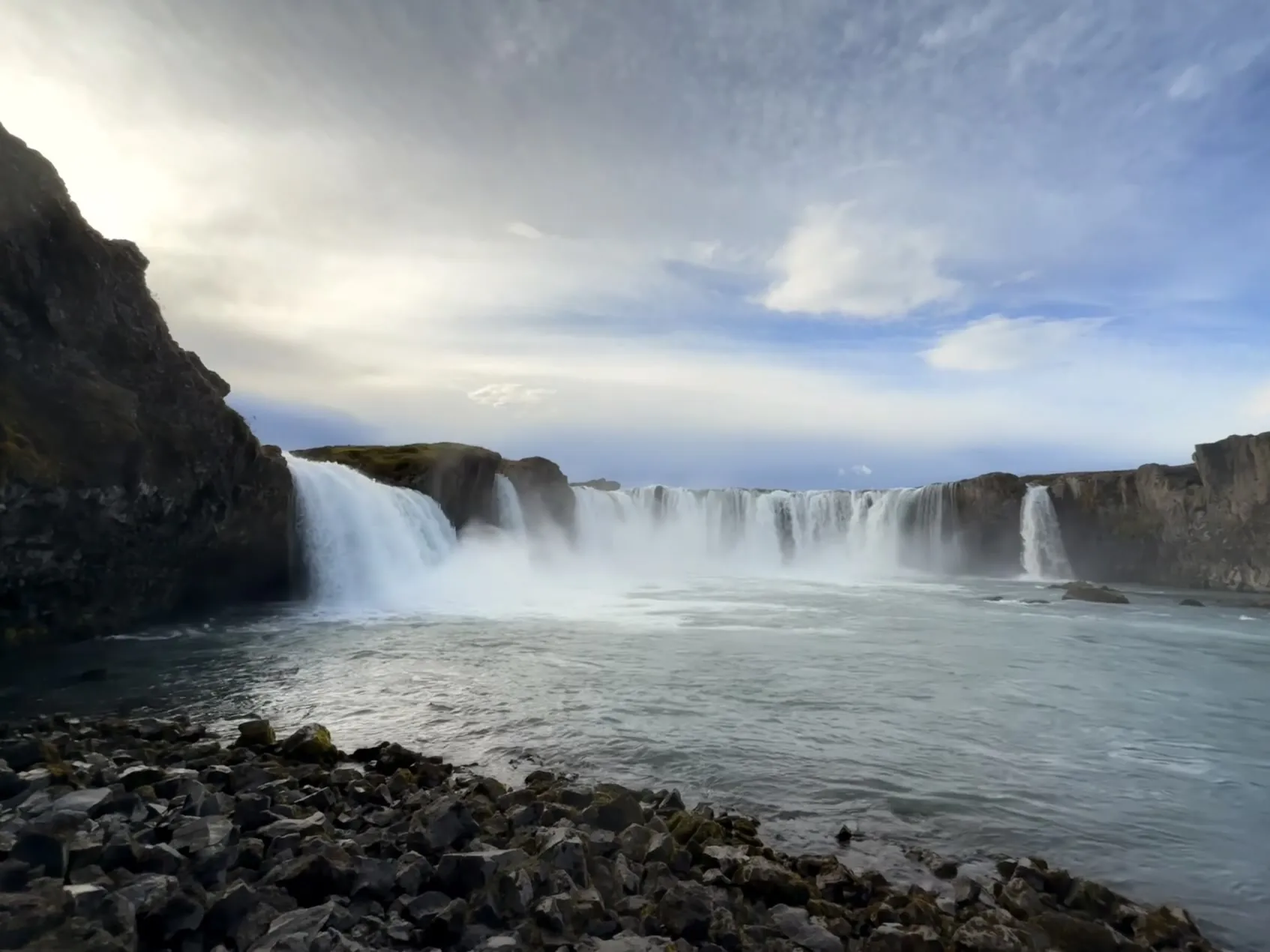
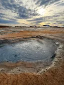
Day four is the long empty one: Hengifoss in the morning, then two hundred kilometres across the interior plateau with almost nothing on it. Day five is Mývatn, where the ground does everything at once — mud pools, a crater a kilometre wide, a cave with impossibly blue water in it — and finishes with Goðafoss and Akureyri.
Day six is the drive back down the west: a three-thousand-year-old crater, and then the mountain off every calendar in the country, which turns out to deserve it. Day seven is the herring boat at Akranes before eight in the morning, the cathedral in Reykjavík, and the airport.
What the camper changes
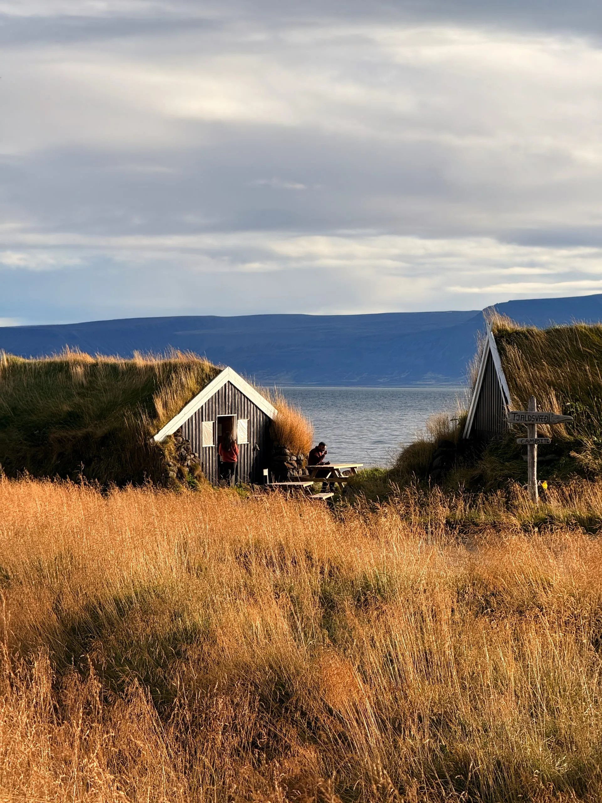
Everything, mostly. You stop where the light is instead of where the booking is, you eat at half nine at night if that is when you get in, and the fifteen minutes between waking up and standing somewhere worth standing is the whole reason four of the frames on this route exist.
It also means the campsites are the itinerary. Wild camping has been illegal since 2015 and is enforced, which sounds restrictive and isn’t — the sites are everywhere, they are cheap, they have hot water and somewhere to cook out of the wind, and a couple of them are better locations than anything you would have booked.
The two things I didn’t plan for
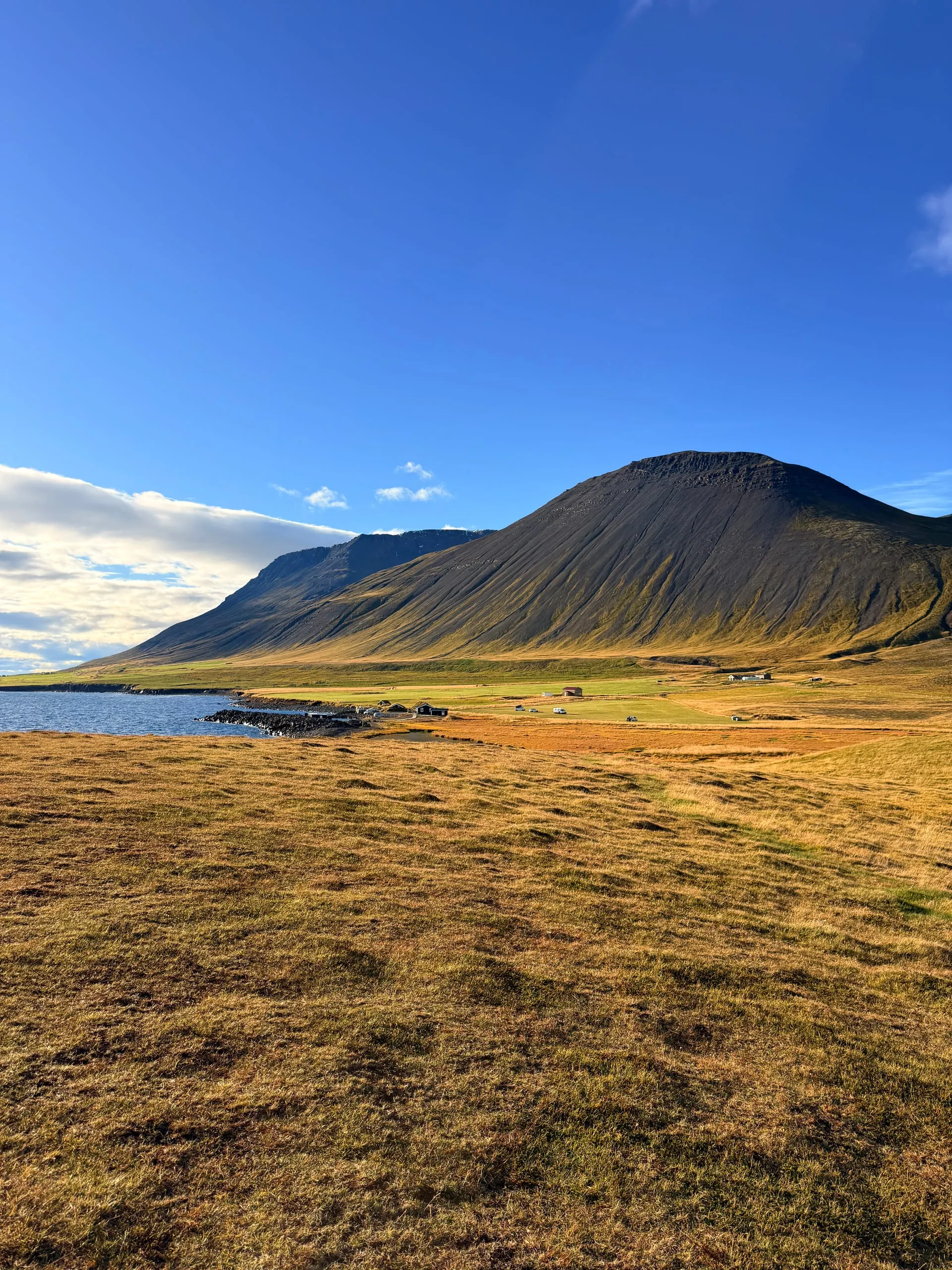
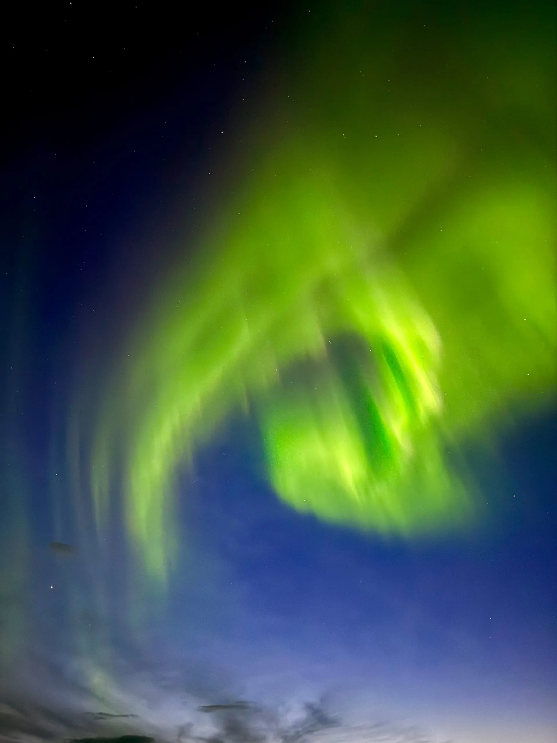
The first was the sky. Two nights on this route gave me things I could not have arranged: the Milky Way standing over Vestrahorn from a headland with no light within tens of kilometres, and then, over Mývatn on the fourth evening, an aurora that filled the top of the sky at seven o’clock and kept going. September is the reason — the nights have got long enough to be properly dark and the roads have not yet started closing.
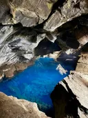
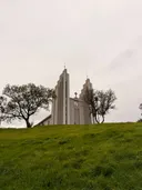
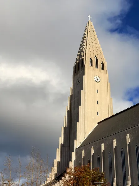
The second was a thread I only noticed on the last morning. The columns at Svartifoss, the ranked hexagons in the cliffs above the east, the torn walls at Grjótagjá — and then two churches, at Akureyri and in Reykjavík, both by Guðjón Samúelsson, both of them that same cliff rendered in poured concrete. A country with almost no building stone and almost no timber went and copied its own geology at building scale. I photographed the source on day two and the copy on day seven without meaning to.
How to use this
Nothing on this route is a way into anywhere — these are national parks, marked trails, signposted car parks and working churches, and the map below is about where to be and when the light is right, not how to get past a fence. The two places to be careful with are the graveyard at Hofskirkja, which is turf and damages easily, and the Viking set at Stokksnes, which is on a farm that charges at the gate and is the only reason the thing is still standing.
The drive above is broken into the seven days as we actually did them, with honest distances. Three of those days are long. If you have nine, put the extra two into the East Fjords and Snæfellsnes.
- 01 Keflavík AirportEyvindarholt
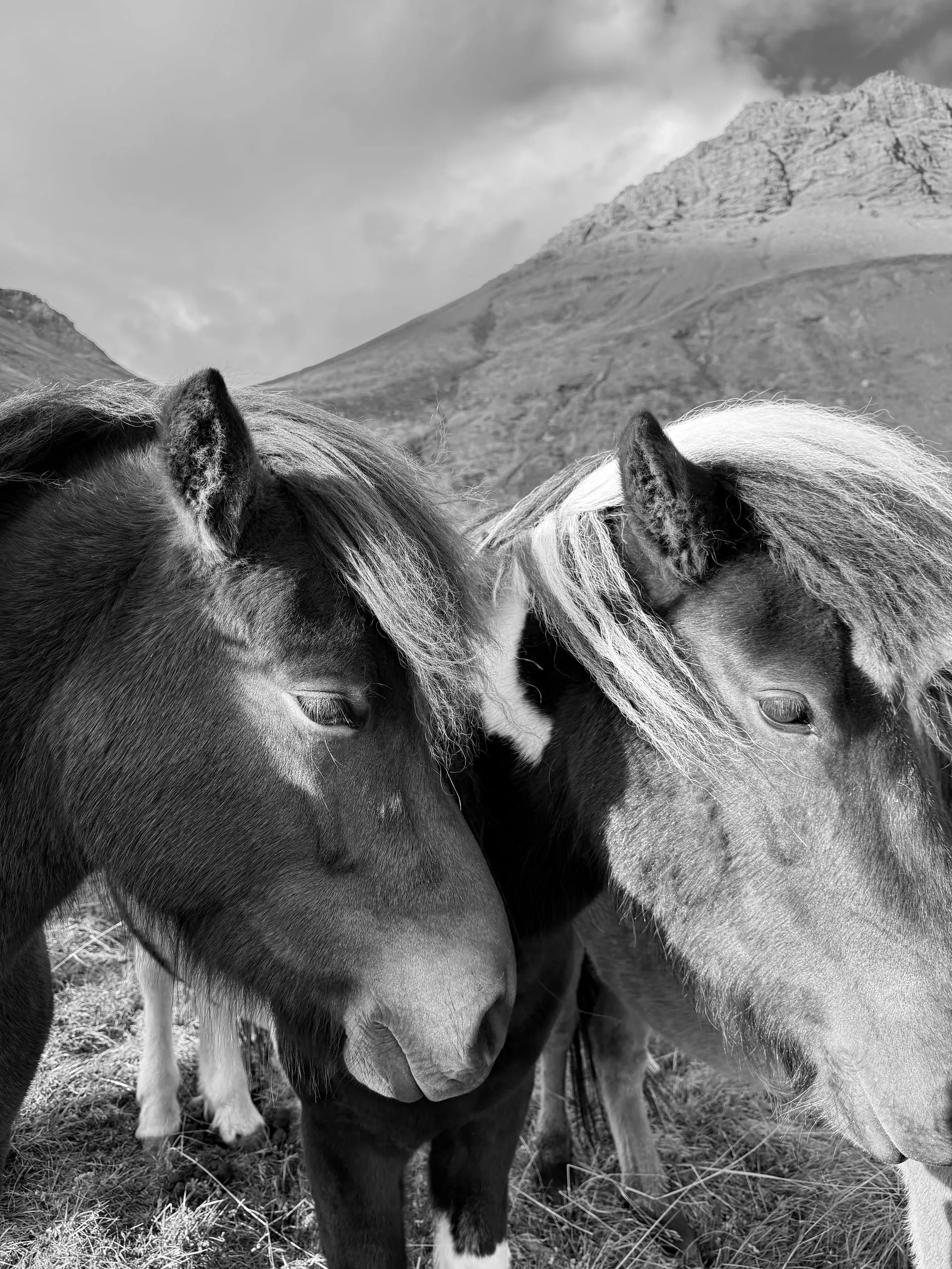
Straight out of the airport and east. Turn up the Þórsmörk road at Seljalandsfoss and the DC-3 is standing in a meadow a few minutes up it. It is a good doorway into the island — nothing around it, no one there, horses in the next field.
2 h · 155 km
- 02
Back down to the main road. Park at Seljalandsfoss with everybody else, then walk five minutes north to the hidden one and wade in. Wet feet by ten in the morning.
0.2 h · 6 km
- 03
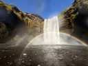
Get there with the sun behind you and the rainbow closes into a full arc on the gravel. Early afternoon in September was exactly right.
0.5 h · 30 km
- 04
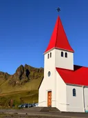
Fuel, food and the church on the hill above the town, which is also the high ground the village would run to if Katla went. Twenty minutes, then push on east.
0.5 h · 33 km
- 05
Time this for the last light. The canyon runs roughly east–west and the far wall holds the sun after the plain has lost it.
1 h · 70 km
- 06 Fjaðrárgljúfur Kirkjubæjarklaustur
Ten minutes to the campsite. Cook in the dark, sleep, and the first stop of day two is a walk from where you're parked.
0.25 h · 12 km
- 07 KirkjubæjarklausturThe chapel
Members
0.1 h · 1 km
- 08
Members
0.2 h · 12 km
- 09
Members
1.2 h · 90 km
- 10
Members
0.4 h · 30 km
- 11
Members
0.6 h · 45 km
- 12
Members
1.2 h · 85 km
- 13 Stokksnes Hvalnes
Members
0.4 h · 27 km
- 14 HvalnesMjóifjörður
Members
3.5 h · 215 km
- 15
Members
0.4 h · 12 km
- 16 Mjóifjörður Egilsstaðir
Members
1.5 h · 75 km
- 19 ReykjahlíðHverir
Members
0.2 h · 7 km
- 20
0.25 h · 10 km
- 21
0.2 h · 6 km
- 22 Grjótagjá Goðafoss
Members
0.7 h · 50 km
- 23 GoðafossAkureyri
Members
0.7 h · 50 km
- 24 Akureyri Skagafjörður
Members
1.5 h · 115 km
- 25 SkagafjörðurGrábrók
Members
2.7 h · 200 km
- 26
Members
1.6 h · 115 km
- 27 Kirkjufell Borgarnes
Members
1.7 h · 120 km
The road into Mjóifjörður
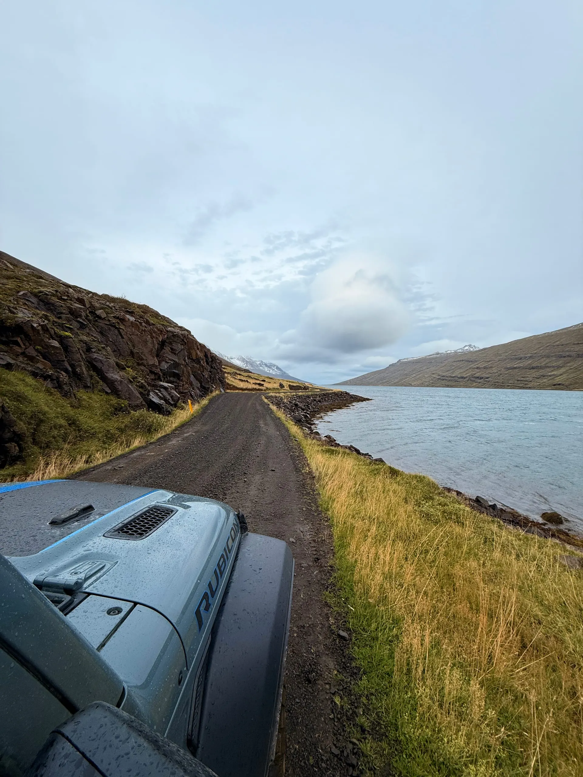
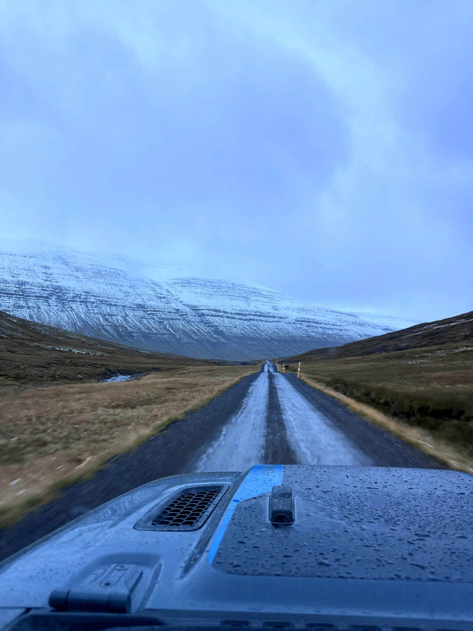
This is the one genuinely dangerous thing on the route, and it is the reason the wreck is worth its own warning. The way in leaves the sealed road, climbs over a pass and drops into the fjord on single track — and in late September it was snow over gravel most of the way, with a drop on one side and no barrier. Loose stone under snow gives you no steering and no braking, and there is nothing up there: no phone signal for stretches of it, no traffic to flag down, and a long way back to Egilsstaðir. Go slowly, go in daylight, leave yourself room to turn around, and check road.is before you commit to the descent. If it has snowed harder than it had for us, don't.
Wild camping is illegal — use the campsites
Parking a camper overnight outside a registered campsite has been against the law since 2015 and it is enforced. In practice this is not a hardship: the campsites are everywhere on this route, they cost very little, and they have hot showers, drinking water, waste disposal and somewhere to cook out of the wind. The Camping Card is worth the money if you are doing a full circuit. Book nothing in advance in September except the night at Stokksnes; everywhere else, turn up.
Everything here is public ground
Unlike the other routes in this journal, almost nothing on this one is a way into anywhere. These are national parks, marked trails, signposted car parks and working churches. The two exceptions worth naming: Hofskirkja is a protected monument and a graveyard, so keep off the turf graves; and the Viking village at Stokksnes sits on private farmland with an access charge at the gate. Pay it. The farm is the reason the set is still standing.
Fuel, and the gap in the middle
Day four crosses the interior plateau between Egilsstaðir and Mývatn with essentially nothing on it. Fill up before you leave Egilsstaðir, not when the gauge suggests it. Iceland runs on unattended pumps: bring a card with a PIN that works at automated terminals, and carry a prepaid fuel key or a second card, because a declined card at a pump at nine at night in the east of the island is a genuinely bad evening.
The whole guide — 22 places, unlocked.
- All 22 places on one map — fourteen route stops and eight side stops
- The exact seven-day order we drove it in, with distances and times
- Where each one is, where to leave the camper, and where to stand
- Which campsites we used, and the one night worth planning around
- Every new route added to the journal, included
One membership unlocks every guide and every location.
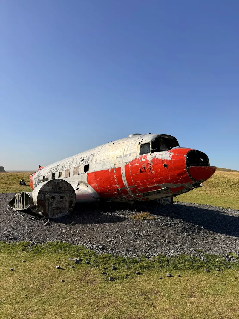
716 Kilometres
Not the one on the black sand. A US Navy DC-3 that crash-landed in July 1969 and was left where it stopped, too expensive to recover — shelter for sheep, climbing frame for somebody's children, for fifty years. In 2023 they picked it up and drove it 716 km across Iceland to a meadow at Eyvindarholt, and stood it on a bed of grey gravel in the grass.
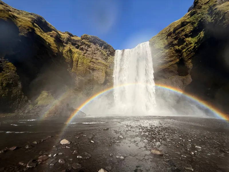
Sixty Metres of Weather
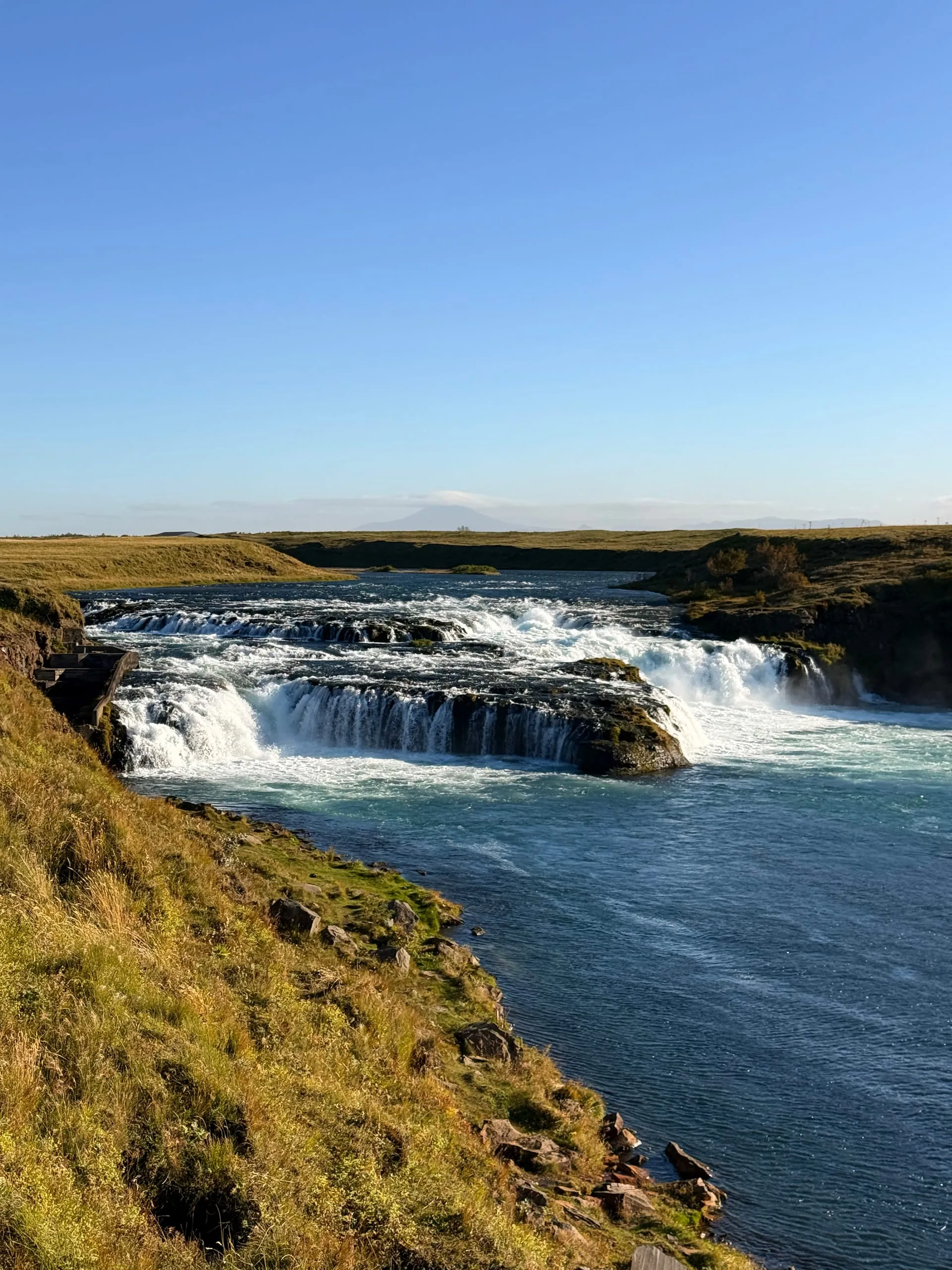
Skógafoss makes its own climate. Sixty metres of river coming off the old sea cliff, and enough water in the air at the bottom that on a clear September afternoon there is a complete rainbow standing on the black gravel in front of it, from one end to the other.
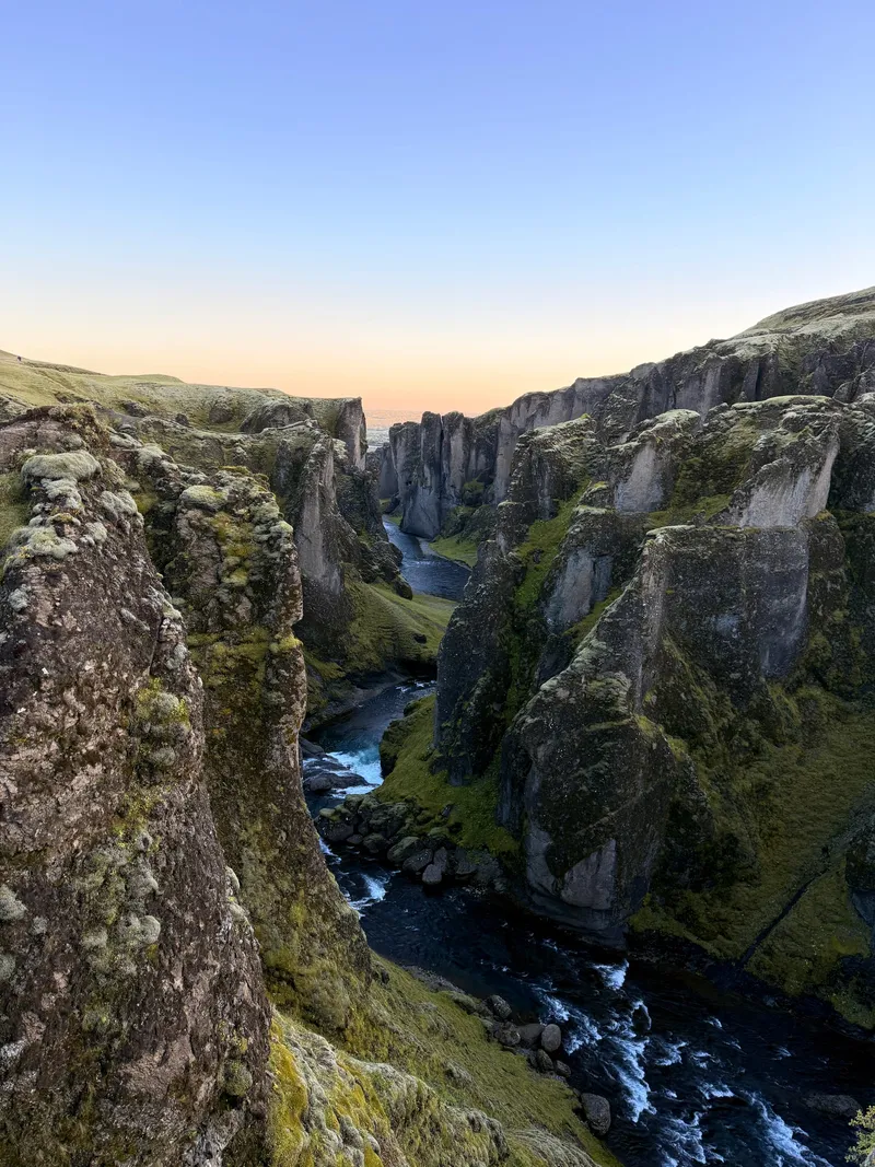
What the Meltwater Cut
A canyon a hundred metres deep and two kilometres long, folded back on itself like something poured rather than eroded. A small river still runs at the bottom of it. The thing that actually dug it stopped existing nine thousand years ago.
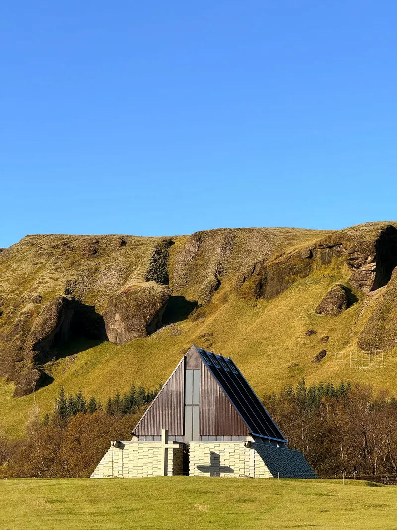
The Fire Sermon
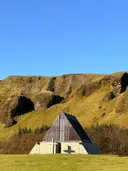
A chapel at Kirkjubæjarklaustur that is essentially one enormous roof set on a low stone base — an A-frame in dark timber and slate, put up in 1974 for a priest who stood in this place in 1783 and preached while the lava came.
Where the Church Came From
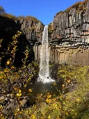
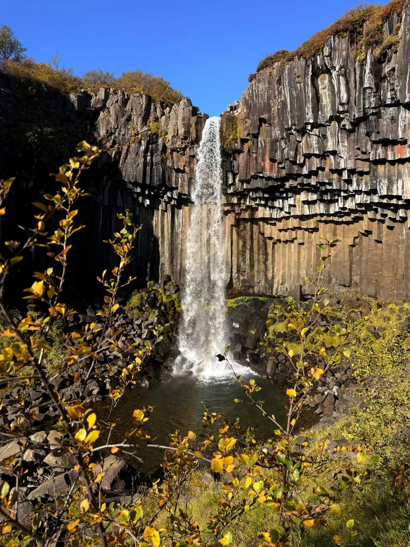
A thin waterfall dropping out of a wall of black basalt columns in Skaftafell — hexagonal, stacked, broken off at the bottom like a pipe organ someone attacked. Reykjavík's cathedral is a copy of this. So is the one in Akureyri.
Under Grass
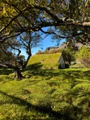
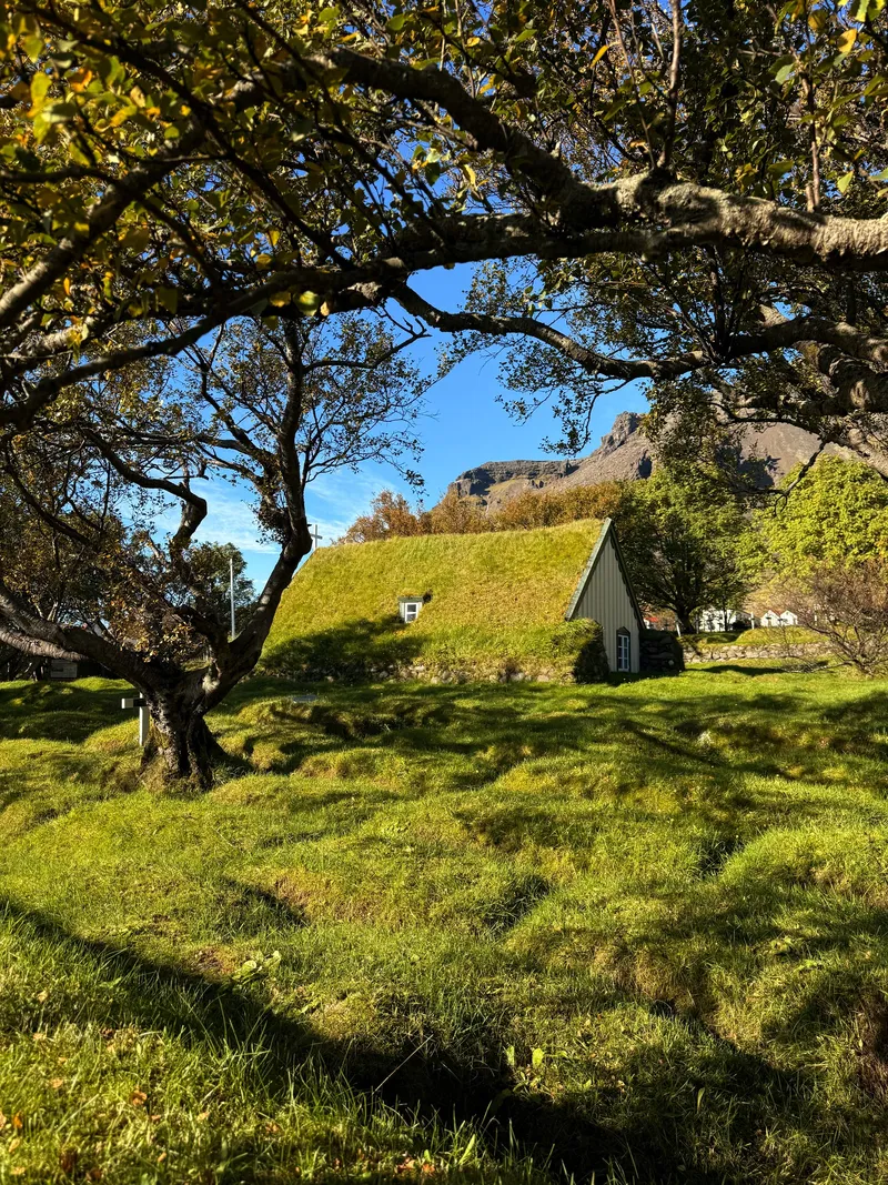
A turf church at Hof, in the Öræfi district under Vatnajökull. Built in 1884, and one of the last ever built the old way — walls and roof of stacked turf, so that from three sides it reads as a low green mound with a gable stuck in the end of it.
Newer Than the Road
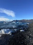
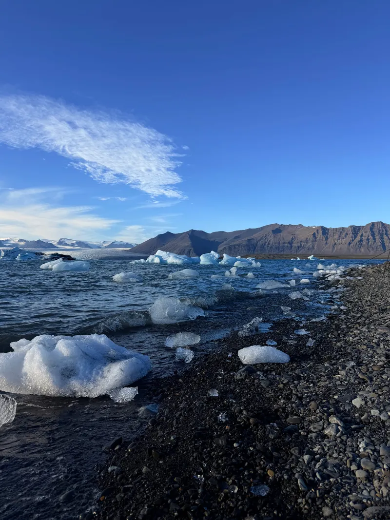
Iceland's deepest lake did not exist when the ring road was first surveyed. Jökulsárlón opened up in the 1930s as Breiðamerkurjökull began pulling back, and it has been growing ever since. The icebergs in it are what's left of snow that fell a thousand years ago.
Never Shot
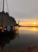
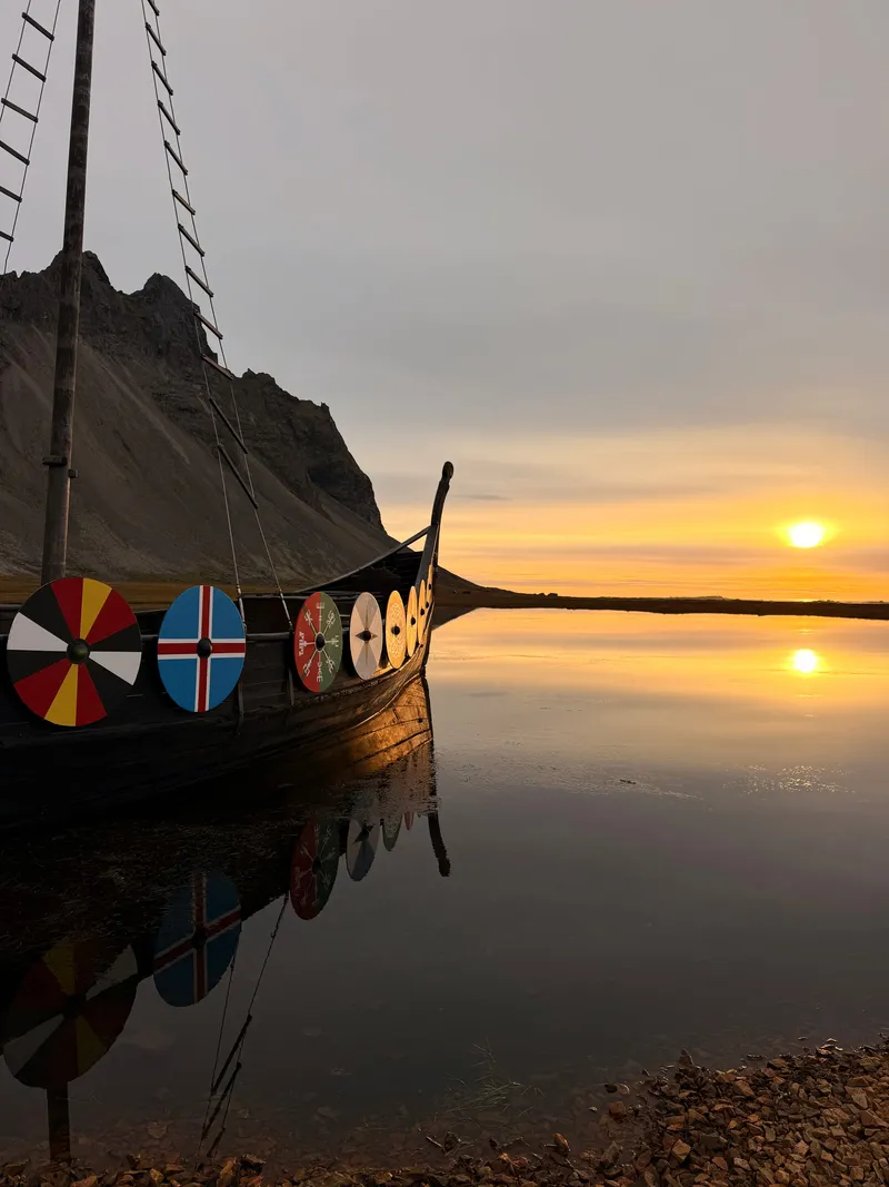
A Viking village on the black sand under Vestrahorn — longhouses, a palisade, a longship with painted shields along the sheer. It was built as a film set around 2010. The film was never made. It has been standing out in the Atlantic weather ever since, being a set for nothing.
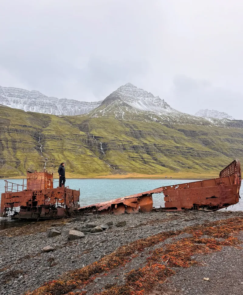
Run Aground
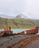
A wartime landing craft rusting at the head of an East Iceland fjord — eighty winters of salt and weather, reached over a mountain pass with a view worth the whole drive.
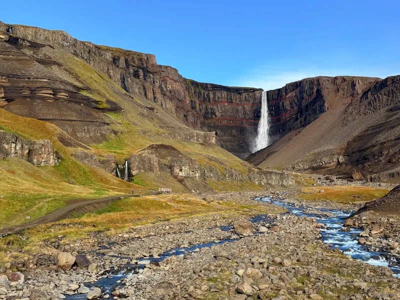
Counting the Eruptions
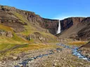
A hundred and twenty-eight metres of water dropping into a bowl in the cliff above Lagarfljót — and the cliff behind it is banded, dark basalt and bright red, over and over. Each red stripe is a soil that had time to form between two lava flows. It is a stack of pauses.
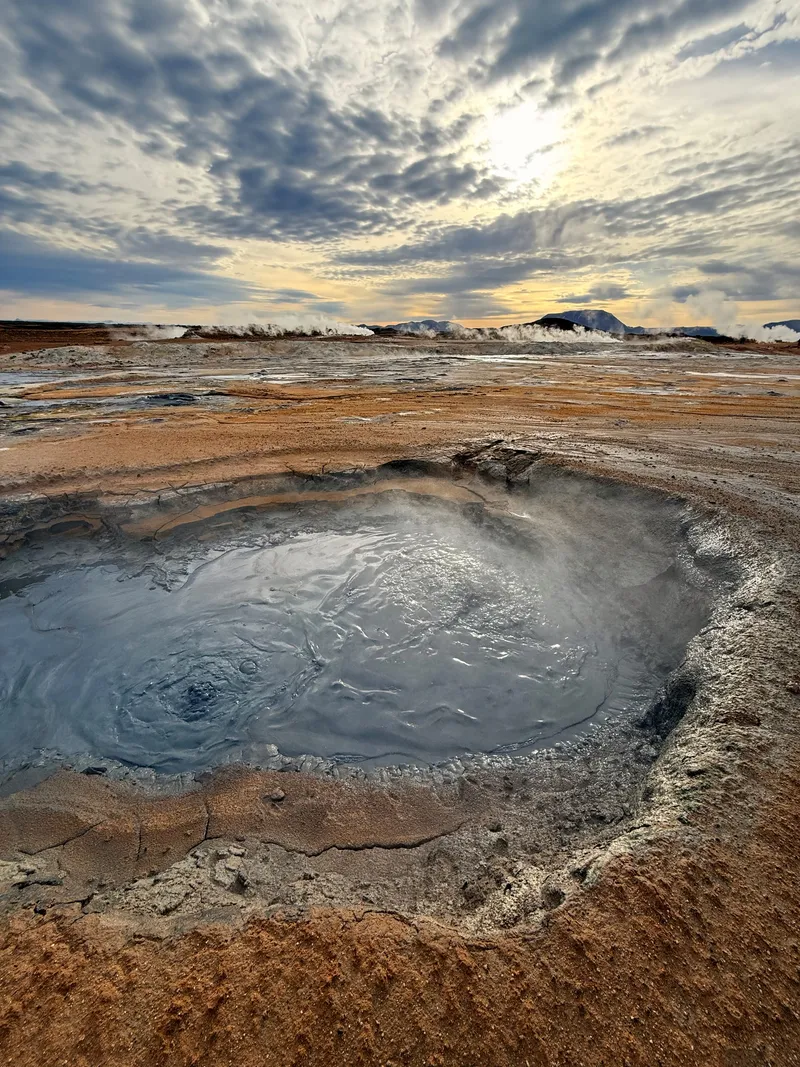
The Ground Boils
A plain of orange mud east of Mývatn where the ground is too hot and too acid for anything to grow on it. Mud pools turning over at walking pace, fumaroles going constantly, and a smell that gets into your clothes and stays for the rest of the week.
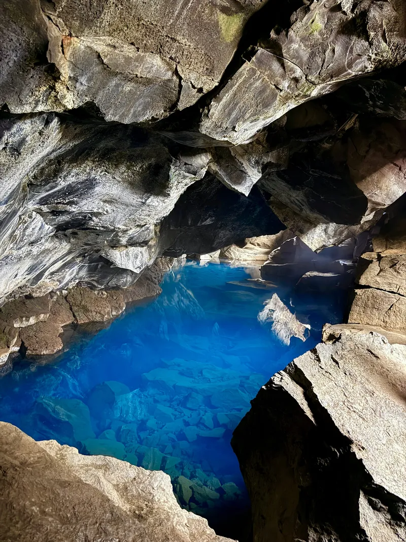
Too Hot to Swim
A fissure in the lava east of Mývatn with a hot spring at the bottom of it — the water an impossible blue in the one shaft of daylight that gets in. People bathed here for generations. Then the Krafla eruptions started in 1975 and the pool got too hot to sit in.
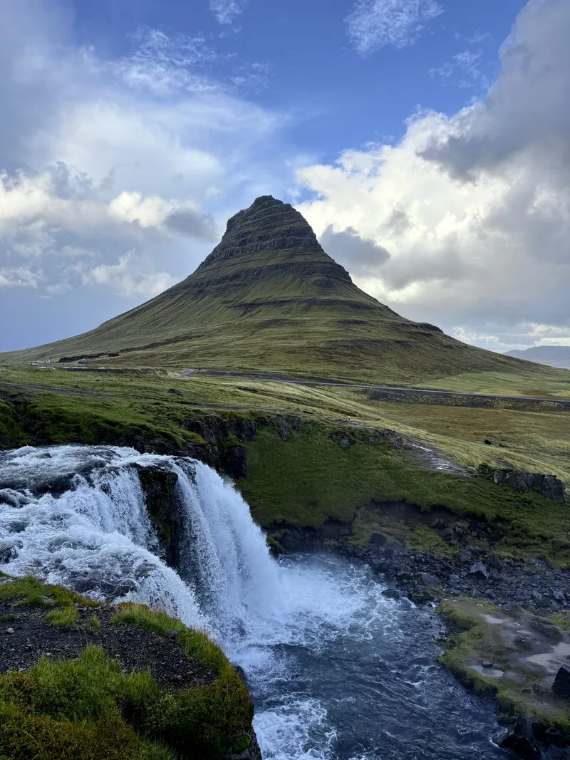
The Church Mountain
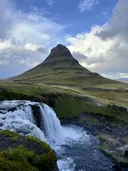
Four hundred and sixty-three metres of stacked sediment and lava standing alone at the edge of a fjord on Snæfellsnes, with a three-step waterfall in the foreground that has made it the most photographed shape in Iceland. It earns it, which is annoying.
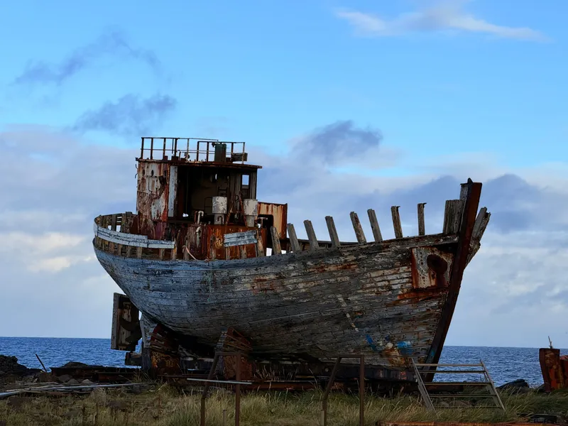
Home Port
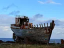
On the north shore of Akranes an old herring boat sits up on a steel cradle, oak planking gone silver, wheelhouse gone to rust. Höfrungur AK 91 — the Dolphin — was built in this town in 1955 and fished for Haraldur Böðvarsson's fleet. She never left. The deck is open to the sky and you can climb aboard and walk the length of her.
Smaller than an entry and kept out of the index — a working metro station, a lived-in block, a studio yard. Some I stood in front of for ten minutes. They're on the map with everything else, so you can decide for yourself whether to give them an hour.
-
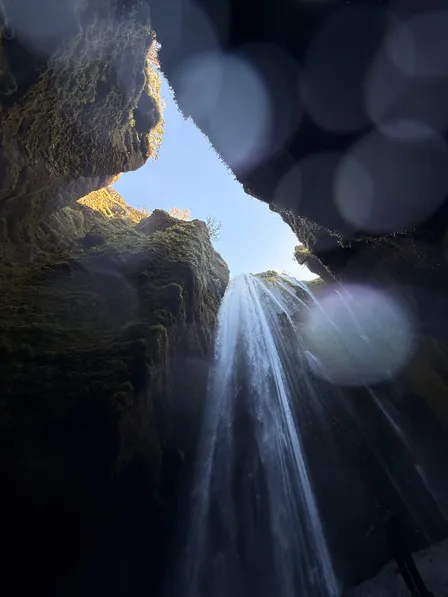 NaturalHamragarðar Iceland
The One Behind the Rock
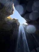
Everybody stops at Seljalandsfoss. Five minutes' walk north there is a second waterfall hidden inside a cleft in the same cliff — you wade up the stream, squeeze through the gap, and it is falling into a room with a slot of sky at the top.
-
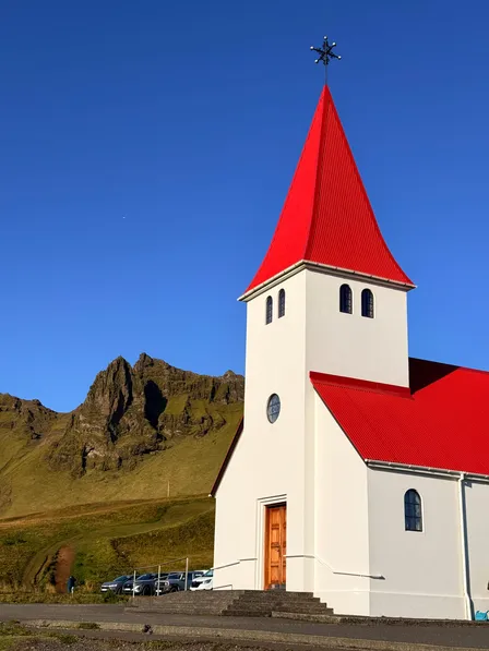 ActiveVík í Mýrdal Iceland
High Ground
The church above Vík stands on a spur with the whole village below it. Red roof, white walls, black cliffs behind. It is also the place everyone in Vík is meant to run to — when Katla goes, this hill is above the flood.
-
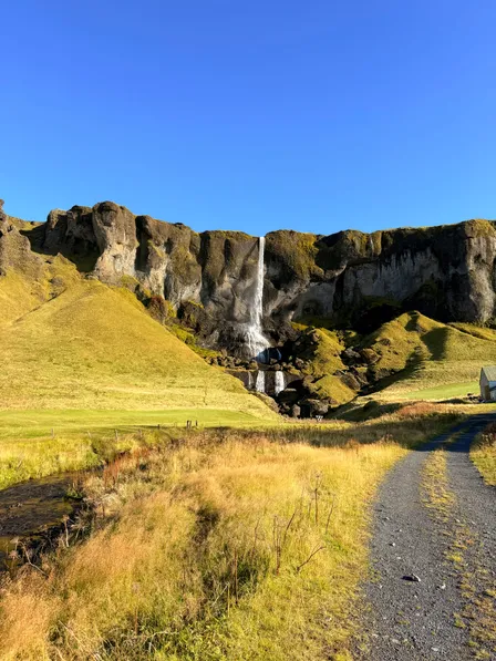 NaturalSíða Iceland
The Farm Called Waterfall
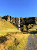
A thin white line coming off the Síða cliffs onto a green field, with a farm at the bottom of it. The farm is called Foss, which means waterfall, because when you have that in your yard there is no point looking for another name.
-
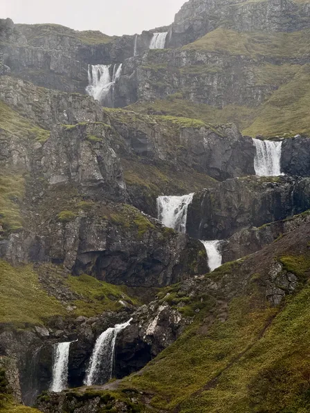 NaturalMjóifjörður Iceland
The Staircase
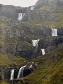
On the road down into Mjóifjörður the whole valley wall is a waterfall — a river coming off the plateau in stage after stage, each one landing in a pool and going over the next lip. You drive past it on the way to the wreck at the end of the fjord.
-
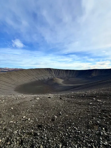 NaturalMývatn Iceland
A Kilometre Across
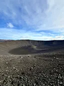
A tephra crater east of Mývatn, almost perfectly round, about a kilometre from rim to rim and a hundred and forty metres deep. You walk up the outside on loose black grit and then the ground just ends and there is a bowl in it.
-
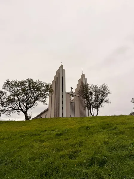 ActiveAkureyri Iceland
Basalt, Again
Akureyri's church, finished in 1940 to Guðjón Samúelsson's design — twin stepped towers in poured concrete, standing on a green bank above the town. The same idea as the cathedral in Reykjavík, six years earlier, and drawn from the same source — a cliff of columns.
-
 ProtectedNorðurárdalur Iceland
Three Thousand Years of Moss
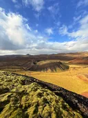
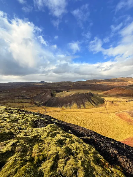
A scoria cone in Norðurárdalur with a staircase up it, and from the top you look down onto its neighbour — a red-black crater sitting in a plain of yellow grass, with the lava it produced still lying around it under a coat of moss.
-
 ActiveReykjavík Iceland
The Columns, Finished
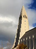
Seventy-four metres of concrete on the hill in the middle of Reykjavík — the front elevation stepping up in ranked shafts on both sides of the tower. Guðjón Samúelsson drew it in 1937. It took until 1986 to finish. It is a cliff face, built.
- Anticlockwise, and why
- Seven days is the minimum, not the target
- Cook your own
- The one night to get right
- Aurora needs dark, not cold
- The basalt thread
- Layers, and a proper shell
- Download the maps
- Showers are the luxury
- Waterproof the lens, not just yourself
10 field notes, and the advice on 24 of the 30 legs, come with the guide. Unlock them below.